
Maps of Egypt were primarily based on Claudius Ptolemy's written directions from antiquity, which, while lacking in detail, aided early explorers in discovering the main sites of ancient Egypt.
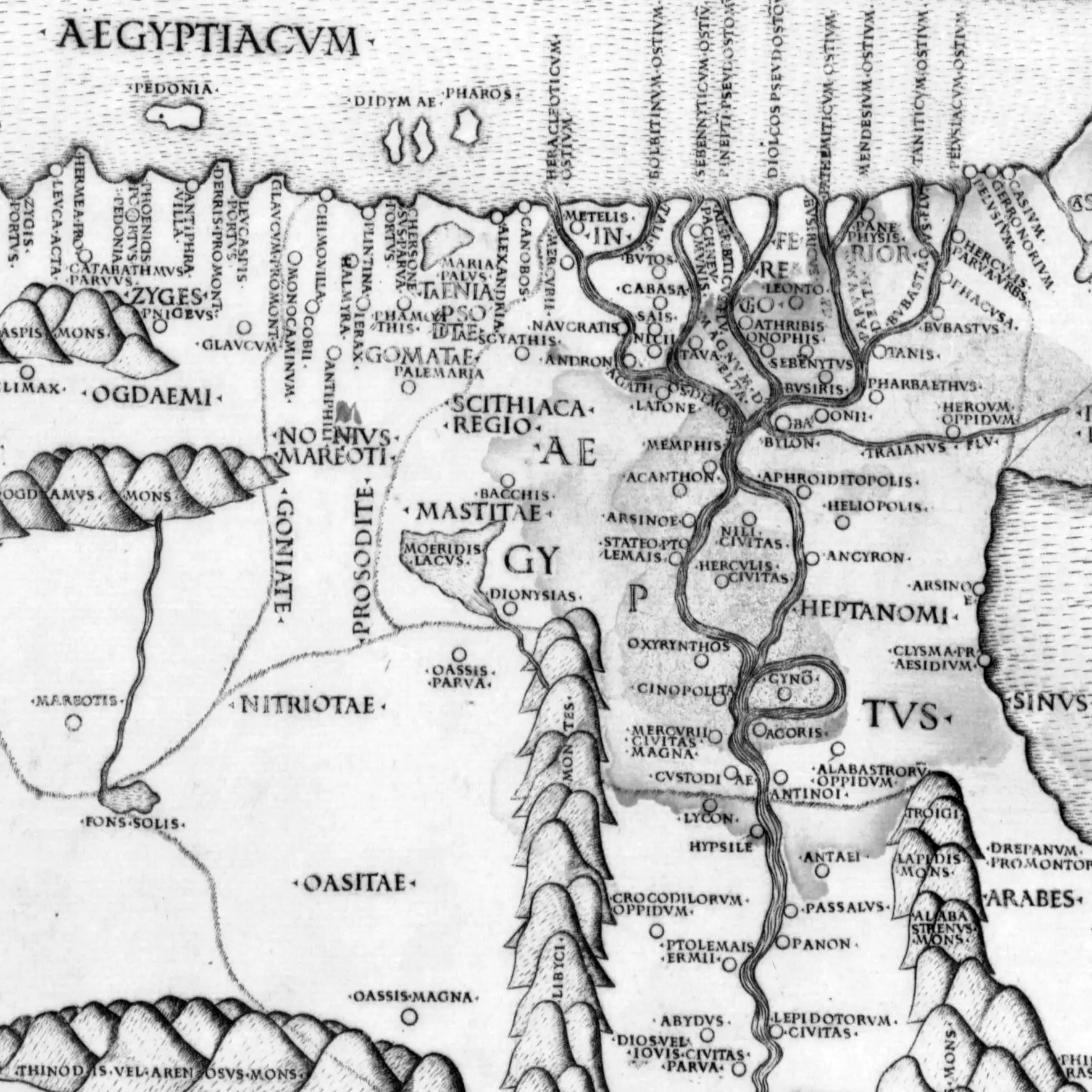
Before the 1700s, maps of the ancient world were notoriously untrustworthy, incorrect, and imprecise, frequently lacking features and ornamented with fanciful monsters and imaginary things. Surviving manuscripts are full of descriptive texts of places, but very seldom do they include anything but the most rudimentary maps.
As with the transmission of manuscripts we must keep in mind is that maps, like books, had to be meticulously reproduced by hand, which naturally resulted in (often significant) discrepancies. The quality of new copies depended very much on the skill of the copyist, and how faithfully the original was duplicated. Some authors could not resist the impulse to add details from their own imagination, as people often do.
Claudius Ptolemy (
His work fell into obscurity and was unnoticed in the West during the Middle Ages. Ptolemy's maps and geographical treatise proved to be a fundamental element in the study of geography and mapping during the Middle Ages, inspiring Islamic and Christian scholars alike. The impact of Ptolemy's cartography is evident in the Tabula Rogeriana, an atlas produced by the Muslim geographer Al-Idrisi in for the Norman king Roger II of Sicily in 1154.
It was not until around 1300 that copies of Ptolemy's maps by Byzantine scholars started circulating in Italy. In 1406, Jacopo d'Angelo, an Italian scholar, translated Ptolemy's original work into Latin. However, the first printed edition of the translation did not appear until 1477 in Rome.

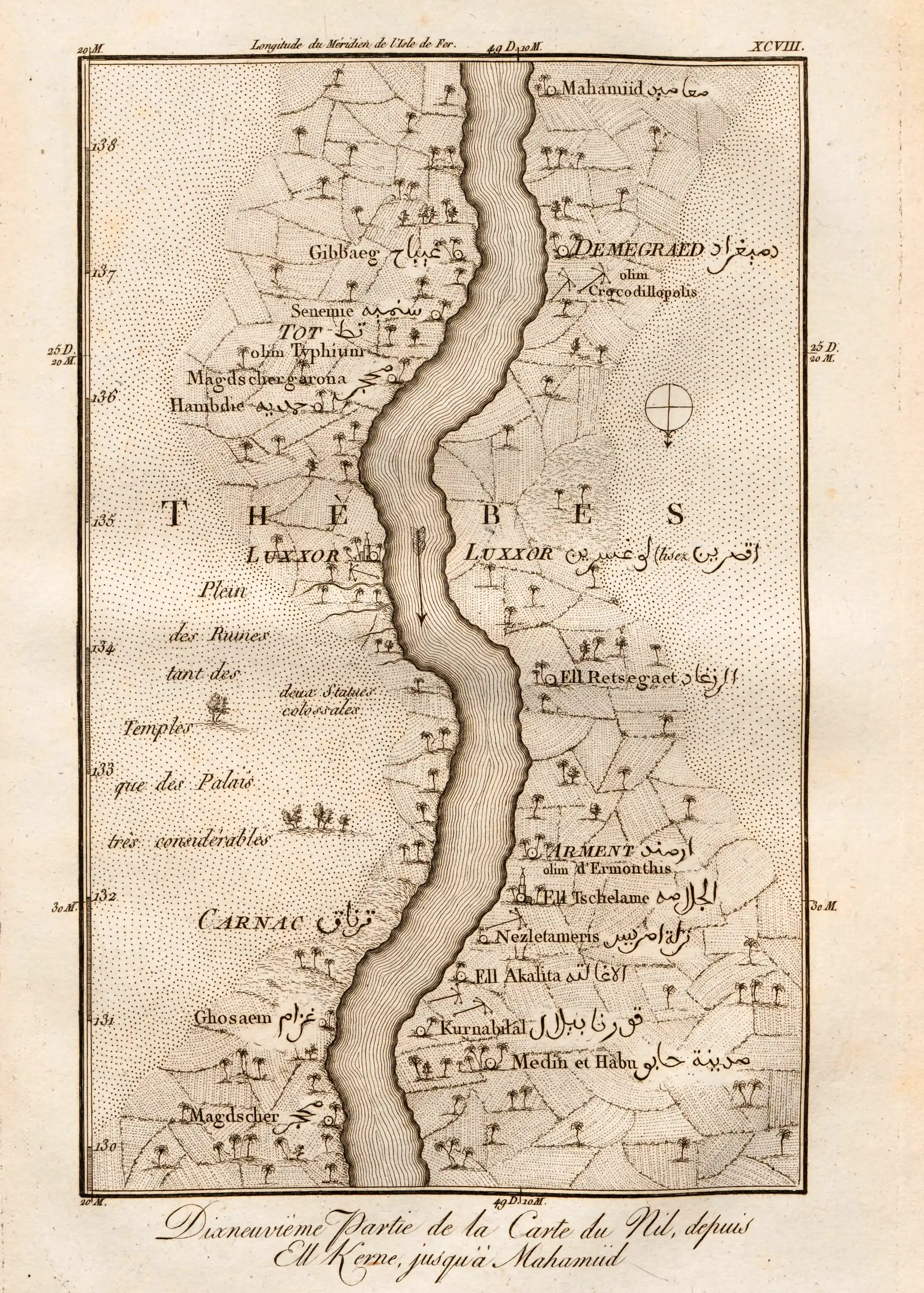
Even though it is obvious from Ptolemy’s map that Thebes is located deep south in Upper Egypt, the location was completely forgotten, other remains close to the delta being mistakenly referred to as Thebes. It was not until the Jesuit priest Claude Sicard (around 1710-20) noticed and marked the vast ruins around Karnak and Luxor as ancient Thebes.
The ancient Egyptian craftsmen were able to build the pyramids and other impressive structures, which would have required, at a minumum, detailed drawings of what was to be built. These plans were presumably written and drawn on papyri, none of which survives. Accordingly, selected sites must have been surveyed before construction even began, and maps drawn up. There is only one surviving map - the Turin Papyrus Map, showing a 15 km (10 mile) stretch of Wadi Hammamat, with topographical and geological details.
In 1737-1738, Frederic Norden, an exceptionally gifted Danish naval commander and explorer travelled up the Nile. Along the way he created the first detailed maps of the whole Nile valley, mostly drawn from the boat. While sailing upriver he encountered another explorer, Richard Pococke, an Englishman who also had journeyed up the Nile and wrote about his adventures.
Instead of replicating Ptolemy, as had long been the practice, French cartographer Jean-Baptiste Bourguignon d’Anville (1697–1782) sought reliable data and was content to leave spaces blank rather than fill them with imaginary features. He stressed the significance of utilizing primary sources and meticulously examined and assessed the available geographical data, such as travel records, astronomical observations, and surveys. He diligently corrected errors in existing maps and incorporated new information, resulting in maps that were considered the most accurate of their time and created the first modern map of the Egypt. D'Anville was a pioneer of thematic cartography that concentrate on specific themes that illustrate physical characteristics, political and historical borders.
In the 19th century, cartography underwent a significant transformation due to technological advancements, increased international collaboration, and the growing recognition of accurate and detailed maps' significance for military, economic, scientific, and educational purposes. These developments formed the basis for further evolution of cartography in the 20th century onwards when highly accurate atlases began to appear.
Claudius Ptolemy’s “Geography”
Excerpts from Book IV, Chapter 5
Written in Alexandria around 150 AD when Antoninus Pius was the Roman emperor.
That is 1875 years ago.
§ 10 –The seven mouths of the Nile: the Herakleotikon or Kanobic, Bolbitinon, Sebennytikon, Pathmitikon, Mendesion, Tanitikon and Pelousiakon mouths.
In Kassiotis: Kassion, Outlet of the Sirbonis lake, Ostrakine, Rhinokoroura, Anthedon
It is bounded on the east by part of Ioudaias (Judaea) which runs from Anthedonos city to Arabia rock as far as the inmost point in the Arabian gulf at Heroon city and by a part of the Arabian gulf, described as follows:
After the above-mentioned inmost point of the gulf: Arsinoe, Klysma fortress, Cape Drepanon, Myos Reef, Philoteras Harbour, Mount Aias, Leukos harbour, Mount Akabe, Nekhesia, Mount Samaragdos, Point Lepte, Berenike, Mount Pentadaktylon, Point Bazion.
The principal cities and areas along the Nile river are as follows:
The so-called Great Delta begins where the Agathodaimon branches off from the Great river and flows through the Herakleotic mouth into the so-called Boubastiakon, which flows out through the Pelusiac mouth.
The so-called Small Delta is where the Boubastiakos river splits into the Bousiritikos river, which flows out through the Pathmitic mouth.
There is a third delta between the two aforementioned, where the Bubastis forks into one that flows through Athribis city and the Pineptimi
mouth. At the Great Delta two rivers branch off toward the north from the river Agathodaimon.
The first is called the Thermouthiakos river,
which flows out through the Sebennytic mouth; the second is the so-called Taly river, which flows through the Bolbitic mouth.
The Boutikos river which runs along at a nearly equal distance from the seacoast joins the Thermouthiakos, the Athribitikos, the Bousiritikos and the Boubastiakos, from which others springing from adjacent marshes and lakes flow into the sea through the remaining mouths, some of which are connected, as we have said, with the Great river.
The area around these rivers is commonly called the
Lower Country, with the following nomes and cities:
West of the Great river starting from the sea, in the Alexandria nome:
the city of Hermopolis Mikra
in the Andropolites nome, the city of Andropolis
In the Letopolites nome, the inland city of Letopolis.
Between the Great river and Taly river in the Metelites nome, the city of Metelis.
Between the Great river and the Thermouthiakos river these cities:
in the Phthenotes nome, the city of Buto
in the Kabasites nome, the city of Kabasa
in the Saites nome, the city of Saïs
Toward the Great river from the west: the city of Naucratis.
From the east toward the Great river: in the Prosopites nome, the city of Nikiou.
Between the Thermouthiakos and the Athribitikos rivers:
in Sebennytes of the Lower Places, the city of Pakhneumounis
in the Xoites nome, the city of Xois
in the Phthemphonthis, the city of Tava.
Between the Athribitikon and the Bousiritikou rivers:
In the Onouphites nome, the city Onouphis
in the Athribites nome, the city Athribis
in the Mendesios nome, the city Thmouis
in the Sebennytes of the Upper Places, the city Sebennytos
in the Bousirites nome, the city Busiris
in the Leontopolites nome, the city Leontopolis.
Between the Bousiritikos and Boubastiakos rivers:
in the Neout or Nesog nome, the city Panephysis
in the Tanites nome, the city of Tanis
in the Pharbaithites nome, the city of Pharbaethos.
From the east of the Boubastikon river is the Sethroites nome: the city of Herakleopolis Mikra
in the Arabias nome, the city of Phakoussa
in the Boubastites nome, the city of Bubastis
in the Heliopolites nome, the city of Heliou/Oniou.
In the border area of Arabias and Aphroditopolis, the Traianos river flows through Babylon, Heliopolis, and Heroonpolis
The area further south from the Great Delta and the Low Country is called the Seven Nomes. The first nome west of the river is Memphites,
and the city of Memphis
Inland on the same side of the river, the town Akanthon.
Then where the river divides, the Herakleopoliten nome forms an island and inland on this island the city of Nilopolis.
The city at the westerly section of the river, Herakleopolis
The west side of the island, the Arsinoites nome, the inland city of Arsinoe and Ptolemais harbour.
The east side of the island, Aphroditopolites nome, the city of Aphroditopolis
Also on the east side of the island, the city of Ankyronpolis.
Adjoining to the west of the river is the Oxyrynkhites nome, and the inland city of Oxyrynkhos(polis)
Then likewise the Kynopolites nome, the city west of the river, Ko
Opposite which on the island lies Kynonpolis
and then on the east bank of the river, Akoris
and in the interior, Alabastron
Then in the Hermopolites nome, inland, west of the river, the city of Hermopolis (Magna)
East of the river in the Antinoites nome, the city of Antinoöpolis
Further south is Thebes and
the Upper Country.
There, from west of the river, is the Lykopolites nome, the inland city Lykonpolis
in the Hypselites nome, the city of Hypsele
in the Aphroditopolites nome, the inland city of Aphroditespolis
then, Krokodeilonpolis
in the Thinites nome, the city Ptolemais or Hermeiou
then inland, likewise west of the river, Abydos
in the Diopolites nome of the Upper Places, the city of Diospolis Mikra
in the Tentyrites nome, the city of Tentyra
and the inland village Pampanis
Next Memnon, in the interior, the village Tathyris.
in the Hermouthites (or Hermonthites) nome, the city of Hermouthis or Hermonthis
and next Latonpolis
then Apollonospolis
then the inland village Phthonthis
and the island of Elephantine.
East of the river: in the Antaiopolites nome, the inland city of Antaioupolis
and next Passalos or Passalon
in the Panopolites nome, the city of Panopolis
(or Panonpolis)
next, Lepidotonpolis
then Khenoboskia
next, Kainepolis
in the Koptites nome, the inland city of Koptos or Koptospolis
next, Apollonospolis Mikra
in the Theban nome, Diospolis Megale
then Touphion
then Khnoubis
then Eilethyiaspolis
then inland, Toou
then Omboi or Ombroi
then Syene.
End of Geographia.
Cities of ancient Egypt
The incredibly long history of Egypt saw cities prosper for long periods, only to be abandoned centuries later after being sacked or buried by the ever present sand of the desert. The names also changed with the times, and foreigners approximated the native name into their own language. Most names we know today come from the Greek variants used in antiquity, but can often be traced back to their original name in ancient Egyptian.
| City | Greek | Coptic | Egyptian | Map |
|---|---|---|---|---|
| Athribis | | | | |
| The town lies around 40 km north of Cairo, on the eastern bank of the Damietta branch of the Nile. It was mainly occupied during the Ptolemaic, Roman, and Byzantine eras. | ||||
| Avaris | | | | |
| The site was originally founded by Amenemhat I. it became the capital for the Hyksos located in the northeastern region of the Nile Delta. | ||||
| Bubastis | | | | |
| Bubastis served as the capital of the nome of the 18th nome of Lower Egypt. Bubastis was situated southwest of Tanis, upon the eastern side of the Pelusiac branch of the Nile. It became a royal residence after Shoshenq I, the first ruler and founder of the 22nd Dynasty, in 943 BC. | ||||
| Buto | | | | |
| Egyptian sources first name the region Djebout, which grew into the twin cities Pe and Dep. From the Ramesside period and on it became known as Per-Wadjet. Based on the descriptions, the mythological floating island of Khemmis (Akh-bit) was close to Buto. | ||||
| Heliopolis | | | | |
| The major surviving remnant of Heliopolis is the obelisk of the Temple of Ra-Atum still standing in its original position, erected by Senusret I of Dynasty XII. Known from the Bible as the city of On. | ||||
| Herakleopolis | | | | |
| Herakleopolis (also called Herakleopolis Magna), was the captial of the Twentieth nome of Upper Egypt. | ||||
| Hermonthis | | | | |
| An important town of the Egyptian Middle Kingdom that was enlarged during the Eighteenth Dynasty. | ||||
| Hermopolis Magna | | | | |
| The capital city of the fifteenth nome of Upper Egypt). The ancient Egyptians called the site Khmun after the group of eight divinities (Ogdoad) that represented the primordial world. | ||||
| Hierakonpolis | | | | |
| Nekhen was an important city in Upper Egypt during the Predynastic period, center for the worship of Horus. | ||||
| Koptos | | | | |
| Its proximity to the Red Sea made it an important trading center between India and Punt, as well as for nearby gold and quartzite mines in the Eastern Desert, and as a starting point for expeditions to Punt. | ||||
| Latopolis | | | | |
| Leontopolis | | | | |
| Letopolis | | | | |
| Center of worship of Khenty-khem, a form of Horus. Mentioned in texts from as far back as the Old Kingdom. Only blocks of stone remains, there is no site as such. | ||||
| Memphis | | | | |
| The capital of Ancient Egypt for much of its history. | ||||
| Mendes | | | | |
| Naucratis | | | | |
| Naucratis was the site of permanent Greek habitation from the sixth century BC onward. | ||||
| Ombos | | | | |
| Located 50 kilometres (31 mi) north of Syene, gave it some control over trade routes from Nubia, but its main rise to prominence came with the erection of the Temple of Kom Ombo in the second century BC. | ||||
| Aphroditopolis | | | | |
| Was a Nile settlement some 40 kilometres south of Thebes. Many objects from the city and the temple of Hathor were sold on the antiquities market in the nineteenth century and are now housed in museums around the world. | ||||
| Pi-Ramesses | | | | |
| Ramesses II constructed the city of Pi-Ramesses roughly 2 km to the north of Avaris, which became its harbour as well as a cemetery. | ||||
| Pithom | | | | |
| The exact location is still somewhat uncertain. | ||||
| Sais | | | | |
| Sais was an town located in the Western Nile Delta. | ||||
| Sebennytos | | | | |
| An ancient city in Lower Egypt located on the Sebennytic branch of the Nile river. | ||||
| Tanis | | | | |
| A city in the north-eastern Nile Delta founded during the Nineteenth dynasty. | ||||
| Xois | | | | |
| Xois sat upon an island belonging to the Sebennytic Nome, and later was the capital of its own nome, the Xoite nome. It has been populated since the Old Kingdom. According to Manetho, Xois was the capital of the invading Hyksos. | ||||
| Thebes | | | | |
| Thebes was the capital of Egypt for long periods during the Middle Kingdom and New Kingdom eras and many impressive structures were built there. It was sacked by the Assyrians in 663 BC, leaving it completely destroyed and in ruins, and it never recovered. | ||||

 https://pharaoh.se/ancient-egypt/cartography/